美国地调局发布2017年美国潜在地震灾害的预测结果
美国地质调查局(USGS)发布2017年美国潜在地震灾害的预测结果
New USGS Maps Identify Potential Ground-Shaking Hazards in 2017
翻译:顾栋炼
说明:地震预报是一个全世界的难题,我们课题组在这个领域可以说还是门外汉。本资料仅供大家了解美国相关研究动向,对其结果是否准确和是否先进我们不加评价。USGS报告原文请点击“阅读原文”
USGS的新地图给出了2017年美国中部和东部地区(CEUS)发生诱发地震和自然地震的概率。这是USGS连续第二年同时预测诱发地震和自然地震这两种危害,之前的USGS地图仅仅对自然地震进行预测。这项研究的成果已经发表在Seismological Research Letters上。New USGS maps identify potential ground-shaking hazards in 2017 from both human-induced and natural earthquakes in the central and eastern U.S., known as the CEUS. This is the second consecutive year both types of hazards are forecasted, as previous USGS maps only identified hazards from natural earthquakes. This research was published today in Seismological Research Letters.
2017年,大约有350万人生活和工作在美国中部和东部破坏性诱发地震发生概率较高的地区。而这350万人中,大部分人都生活在俄克拉荷马州和堪萨斯州南部。Approximately 3.5 million people live and work in areas of the CEUS with significant potential for damaging shaking from induced seismicity in 2017. The majority of this population is in Oklahoma and southern Kansas.
研究还显示,2017年CEUS还有50万人面临着较高发生概率的自然地震,这使得CEUS处于自然地震和诱发地震高风险地区的总人数达到400万人。Research also shows that an additional half million people in the CEUS face a significant chance of damage from natural earthquakes in 2017, which brings the total number of people at high risk from both natural and human-induced earthquakes to about 4 million.
USGS National Seismic Hazard Mapping Project(USGS国家地震灾害风险图项目)的负责人—Mark Petersen说:“好消息是,今年的整体地震危害性要低于2016年的预测结果,尽管如此,在未来一年中CEUS还是有较高的可能性遭遇破坏性地震。”“The good news is that the overall seismic hazard for this year is lower than in the 2016 forecast, but despite this decrease, there is still a significant likelihood for damaging ground shaking in the CEUS in the year ahead,” said Mark Petersen, chief of the USGS National Seismic Hazard Mapping Project.
2017年预测结果之所以比2016年乐观,是因为与2015年相比,2016年的有感地震次数更少。而造成这种现象的原因,可能是当局监管措施使得注入地下的废水量减少,石油、天然气的价格走低导致石油和天然气减产也可能是一部分原因。The 2017 forecast decreased compared to last year because fewer felt earthquakes occurred in 2016 than in 2015. This may be due to a decrease in wastewater injection resulting from regulatory actions and/or from a decrease in oil and gas production due to lower prices.
尽管2016年全美地震总数相对减少,但在2016年俄克拉荷马州遭遇了该州历史上记录到的震级最大的地震,且2016年也是该州历史上遭遇大震次数最多的一年。此外,Petersen指出:受政策和工业活动影响,美国诱发地震的危害性将继续波动。Despite the decrease in the overall number of earthquakes in 2016, Oklahoma experienced the largest earthquake ever recorded in the state as well as the greatest number of large earthquakes compared to any prior year. Furthermore, the chance of damage from induced earthquakes will continue to fluctuate depending on policy and industry decisions, Petersen noted.
“2017年自然地震和诱发地震风险的预测结果要比2008年之前高出数百倍,2008年后诱发地震所占比例迅速增加,”Petersen 说,“数百万人仍然面临着较高概率的破坏性地震,概率大小可能随着难以预测的工业活动变化而发生波动。”“The forecast for induced and natural earthquakes in 2017 is hundreds of times higher than before induced seismicity rates rapidly increased around 2008,” said Petersen. “Millions still face a significant chance of experiencing damaging earthquakes, and this could increase or decrease with industry practices, which are difficult to anticipate.”
注释:针对美国西部(与CEUS相比),USGS的科学家主要致力于研究自然地震危害。当然,加州也记录到了诱发地震,但由于西部自然地震频繁,西部区域地震危害整体等级已经很高,使得偶尔发生的诱发地震并不能对其造成显著影响。Important Note: In the west, USGS scientists have focused on the hazard from natural earthquakes. Induced earthquakes have been observed in California as well, but they don’t significantly change the regional hazard level, which is already high due to frequent natural earthquakes.

USGS地图:预测了美国2017年遭受自然地震或者诱发地震的风险。概率最小低于1%,最高达12%
什么是诱发地震? What are Induced Earthquakes?
诱发地震是由人类活动引发的地震,废水处理是CEUS许多地区诱发地震发生的主要原因。在石油和天然气行业,可以将废水注入地下井来处理。注入的流体会导致地下压力变化,从而削弱了场地,使得场地更加接近断裂极限。大多数往地下井注入废水的活动不会引发有感地震,这说明只有在很多因素综合作用下,诱发地震才会发生。Induced earthquakes are triggered by human activities, with wastewater disposal being the primary cause in many areas of the CEUS. Wastewater from oil and gas operations can be disposed of by injecting it into deep underground wells. Injected fluids cause pressure changes that can weaken a fault and therefore bring it closer to failure. Most injection wells do not trigger felt earthquakes, suggesting that a combination of many factors contribute to such events.
Petersen说:“通过理解地震和废水注入地下井的关系,可以采取一些预防措施,譬如控制注入废水的体积和速率,亦或者确定哪些地下井最容易诱发地震。”“By understanding the relationship between earthquakes and wastewater injection, informed decisions can be made on processes such as controlling the volumes and rates of wastewater injected and determining which wells are most susceptible to inducing earthquakes,” said Petersen.
有关水力压裂的一些问题(通常被称为“fracking”),可以参见common questions。Many questions have been raised about hydraulic fracturing—commonly referred to as “fracking”—and more information can be found by reading common questions.
高危害性州 States with High Hazard
USGS地图指出了2017年CEUS的五个高地震危害性地区。这些地区同样也进了2016年的高危害性地区预测名单。The maps indicate an especially high ground-shaking hazard in five areas of the CEUS in 2017. These same areas were identified in the 2016 forecast.
俄克拉荷马州/堪萨斯州南部和被称为拉顿盆地的科罗拉多州/新墨西哥州,这两个地区诱发地震的危害性最高,2017年这两个地区很有可能发生破坏性地震。Induced seismicity poses the highest hazard in two areas, which are Oklahoma/southern Kansas and the Colorado/New Mexico area known as the Raton Basin. In those areas, there is a significant chance that damaging levels of ground motion will occur in 2017.
研究人员观测到德克萨斯州和阿肯色州北部的诱发地震危害性有所增加,但其危害性水平仍然远低于2016年的预测结果。虽然地震仍然是一个问题,但科学家在过去一年并没有观察到显著的地震活动,所以预测2017年的危害性较低。Enhanced hazard from induced seismicity was also found in Texas and north Arkansas, but the levels are significantly lower in these regions than that forecasted for 2016. While earthquakes are still a concern, scientists did not observe significant activity in the past year, so the forecasted hazard is lower in 2017.
从2017年的预测图来看,新马德里地震带(NMSZ)自然地震危害性较高,NMSZ是5个高危害性地区中唯一一个尚未遭遇诱发地震的地区。过去三年里NMSZ的自然地震发生频率较高,这导致阿肯色州,密苏里州,伊利诺伊州,肯塔基州,田纳西州部分地区的地震危害性较前几年略高。There is also a high hazard for natural earthquakes in the New Madrid Seismic Zone. The NMSZ is the only one of the five identified areas that has not experienced induced earthquake activity. The NMSZ had a higher rate of natural earthquakes in the past three years, leading to a slightly higher hazard potential compared to previous years in portions of Arkansas, Missouri, Illinois, Kentucky and Tennessee.
“2016年的预测在评估危险地区方面非常准确,特别是在俄克拉荷马州,” Petersen说,“正如2016年的预测结果,过去一年俄克拉荷马州遭遇了严重的地震损失,不过,2016年德克萨斯北部和阿肯色州的地震数量明显减少,2016年预测模型对此并没能成功预测,造成这种现象的原因可能是注水处理活动的减少。”“The 2016 forecast was quite accurate in assessing hazardous areas, especially in Oklahoma,” said Petersen. “Significant damage was experienced in Oklahoma during the past year as was forecasted in the 2016 model. However, the significantly decreased number of earthquakes in north Texas and Arkansas was not expected, and this was likely due to a decline in injection activity.”
Petersen说:“由于目前建筑规范中仅考虑了自然地震危害性,预测的美国中部地区危害性水平要高于规范中考虑的水平,这使得美国中部地区备受担忧。”“There is specific concern in parts of the central U.S. since the forecasted hazard levels are higher than what is considered in current building codes, which only incorporate natural earthquakes,” said Petersen.
生活在地震危害性较高地区的人应该学习如何备灾。相关指导可参见FEMA's Ready Campaign。People living in areas of higher earthquake hazard should learn how to be prepared for earthquakes. Guidance can be found through FEMA’s Ready Campaign.

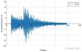
USGS图表给出了从1980年到2016年,上述5个重点地区超过或等于2.7级的地震数量。USGS charts showing the number of earthquakes greater than or equal to magnitude 2.7 since 1980 in the five focus areas identified as having especially high ground-shaking hazard in the central and eastern U.S. in 2017.
聚焦俄克拉荷马州 Spotlight on Oklahoma
1980年至2000年间,俄克拉荷马州每年平均发生两次大于或等于2.7级的地震。然而,这一数字在2014年跃升到约2500次,2015年则达到4000次,2016年为2500次。2016年这一数字有所下降,部分原因可能是州政府对废水注入地下井这种处理方式的限制。在俄克拉荷马州去年发生的所有地震中,有21次地震超过4.0级,3次超过5.0级。Between 1980 and 2000, Oklahoma averaged about two earthquakes greater than or equal to magnitude 2.7 per year. However, this number jumped to about 2,500 in 2014, 4,000 in 2015 and 2,500 in 2016. The decline in 2016 may be due in part to injection restrictions implemented by the state officials. Of the earthquakes last year, 21 were greater than magnitude 4.0 and three were greater than magnitude 5.0.
USGS的研究认为2.7级的地震属于有感地震,4.0级及4.0级以上地震能造成轻微及轻微以上的破坏。USGS research considers a magnitude 2.7 earthquake to be the level at which ground shaking can be felt. An earthquake of magnitude 4.0 or greater can cause minor or more significant damage.
预测结果显示,俄克拉荷马州中部地区破坏性地震的发生概率与加利福尼亚州高危害性地区自然地震的发生概率相近。The forecasted chance of damaging ground shaking in central Oklahoma is similar to that of natural earthquakes in high-hazard areas of California.
Petersen :“我们预测,大部分结构的破坏形式将是石膏板或者非配筋砌体的开裂。然而,部分地区也有可能发生破坏力更强的地震,遭遇更加严重的损失。” “Most of the damage we forecast will be cracking of plaster or unreinforced masonry. However, stronger ground shaking could also occur in some areas, which could cause more significant damage," said Petersen.

USGS地图比较了2016年和2017年俄克拉荷马州遭受自然地震或者诱发地震破坏的风险。USGS maps comparing the potential to experience damage from a natural or human-induced earthquake in Oklahoma in 2016 and 2017.
保护社区 Protecting Communities
新的报告有助于政府提前做出增强国家抗震能力的决策,并能为那些处于强震风险地区的人们提供安全信息。例如,2016年的预测结果已被工程师用来评估建筑物、桥梁、管道等重要结构的地震安全。风险模型师利用数据开发新的风险评估模型来更好地了解地震风险对保险费的潜在影响。美国陆军工程兵团以这些信息为指导来更新他们指定设施的安全评估。The new report is valuable for making informed decisions to reduce the nation’s vulnerability and providing safety information to those who may be at risk from strong shaking. For example, the 2016 forecast has been used by engineers to evaluate earthquake safety of buildings, bridges, pipelines and other important structures. Risk modelers have used data in developing new risk assessments, which can be used to better understand potential impacts on insurance premiums. The U.S. Army Corps of Engineers has used the information to provide guidance on updating their safety assessments of selected facilities.
监管机构、行业和科学家们的持续合作,对减少危害、提高将来的预测精度和加强备灾工作等是重要的。Continuing collaborations between regulators, industry, and scientists will be important toward reducing hazard, improving future forecasts, and enhancing preparedness.
美国中西部对比 Central versus Western U.S.
近年来,CEUS地区诱发地震的发生频率显著增加。正因如此,在2016年和2017年的预测中,科学家们只对CEUS地区的诱发地震和自然地震进行了区分。科学家们还采用了包含17世纪以来的历史地震目录,并在预测时着重关注了近两年发生的地震事件。In recent years, the CEUS has experienced a significant increase in induced earthquakes. Therefore, in the 2017 and 2016 forecasts, scientists distinguish between human-induced and natural seismicity only for the CEUS. Scientists also used a historical catalog of seismic events dating back to the 1700s, putting a strong emphasis on earthquakes that occurred during the last 2 years.
Petersen指出,未来的研究可以对包括加州Geysers、Brawley以及洛杉矶盆地小部分地区在内的西部地区的诱发地震进行更详细的分析。Future research, noted Petersen, could take a more detailed look at induced seismicity in the west, including in California at The Geysers, Brawley and small areas of the Los Angeles Basin.
区分诱发地震和自然地震 Distinguishing Between Induced and Natural Earthquakes
USGS依靠查阅文献,和与政府官员、科学界和地震工程界相关人员的讨论来确定某个地震序列是自然地震还是诱发地震。科学家们主要判断该次地震是否发生在用于废水处理的深井旁边,以及地震期间该深井是否活跃。如果符合上述条件,那么该次地震就被归类为诱发地震。To determine whether particular clusters of earthquakes were natural or induced, the USGS relied on published literature and discussions with state officials and the scientific and earthquake engineering community. Scientists looked at factors such as whether an earthquake occurred near a wastewater disposal well and whether the well was active during the time the earthquakes occurred. If so, it was classified as an induced event.
展望未来一年 One-Year Outlook
之所以只对未来一年进行展望,是因为诱发地震数量会随着时间波动,且易受快速变化的商业活动和政策影响。2016年和2017年采用的是相同的预测方法,唯一不同的是,2017年预测模型根据2016年地震事件进行了历史地震目录更新。这样做就可以进行连续两年预测结果的直接比较。The one-year outlook is chosen because induced earthquake activity can increase or decrease with time and is subject to commercial and policy decisions that could change rapidly. The 2016 and 2017 forecasts employ identical methodologies; the only difference is that the 2017 forecast includes an updated earthquake catalog with 2016 events. This allows for a direct comparison from one year to the next.
相比之下,USGS National Seismic Hazard Map(USGS国家地震危害性地图)评估了自然地震,并进行了未来50年的危害性预测。选择这样一个时间间隔是因为建筑的平均寿命为50年,50年的预测信息对于工程设计和建筑规范的修订至关重要。In contrast, the USGS National Seismic Hazard Map assesses natural earthquake hazards and uses a 50-year forecast. That timeframe was chosen because that is the average lifetime of a building, and such information is essential to engineering design and the development of building codes.
USGS科学 USGS Science
USGS是美国唯一一个负责记录和报告全国地震活动,并对地震危害进行评估的联邦机构。这些地图是USGS对NEHRP项目贡献的一部分。该项目由美国国会牵头,四个联邦机构共同建立,旨在降低地震对美国造成的生命和财产风险。The USGS is the only federal agency with responsibility for recording and reporting earthquake activity nationwide and assessing seismic hazard. These maps are part of USGS contributions to the National Earthquake Hazards Reduction Program, which is a congressionally established partnership of four federal agencies with the purpose of reducing risks to life and property in the United States that result from earthquakes.

USGS地图给出了2015年和2016年CEUS地区的地震事件。其中包括俄克拉荷马-堪萨斯州、拉顿盆地、德克萨斯州北部以及新马德里地震带在内的五个地区的地震危害性较高。USGS map displaying seismic events in 2015 and 2016 in the central and eastern U.S. There is a high hazard for earthquakes in five areas, which are Oklahoma-Kansas, the Raton Basin, north Texas, north Arkansas, and the New Madrid Seismic Zone.

USGS地图给出了俄克拉荷马州和拉顿盆地在2016年发生的4.0级及4.0级以上地震的位置。USGS map showing the location of earthquakes greater than or equal to magnitude 4.0 in Oklahoma and the Raton Basin in 2016.

USGS地图给出了潜在自然和人为地震烈度分布。这些地区有一个很小的概率(百分之一)遭遇这一地震烈度或高于这一烈度。遭遇地震烈度小于这一烈度的概率要大很多(99%)
相关研究
相关文章,在仿真秀官网搜索:
2月27日前注册,可以领取最高3000美元奖励!
美国十亿美元“全国防灾韧性竞赛National Disaster Resilience Competition”结果揭晓
美国基金委4千万美元多灾害试验研究中心竞争结果公布
洛杉矶市通过美国最强硬的地震安全法律,要求必须对不安全建筑进行抗震加固
三本国际土木工程期刊热点论文调查
中国大陆主要城市建筑地震灾害风险分析初探
提高地震荷载分项系数,抗震安全性提高了多少?
下一代性能化设计方法在区域地震经济损失预测中的应用


